The number of buildings located in flood areas has doubled in Greater Montreal, according to maps posted online Monday by the Montreal Metropolitan Community (CMM) – who wants to encourage citizens to participate in public consultations on the subject.
Nearly 15,000 buildings in Greater Montreal are in flood zones, according to preliminary maps from the CMM. These buildings contain more than 19,000 housing units.
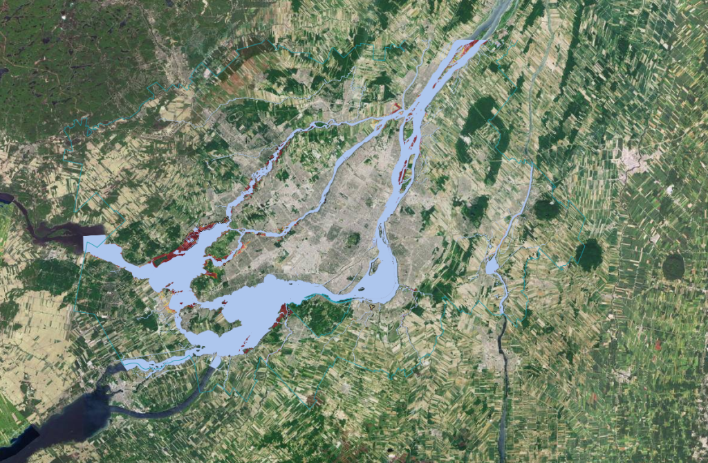
This is approximately double the number of buildings that were previously located in flood zones and “it also represents $9.9 billion in property value,” explained Nicolas Milot, interim director of ecological transition and innovation at the CMM, at a technical briefing for the media last Friday.
Pierrefonds and Vaudreuil-Dorion are examples of cities that would be “strongly impacted” by the new regulations, Milot said.
“Vaudreuil-Dorion was almost our perfect students before, there were no houses in flood zones (…), but the new ratings mean that there will be an expansion in their area.”
In Pointe-Calumet, in the Laurentians, almost the entire territory would be considered a flood zone with the new regulations.
Low, moderate, high, and very high risk
The maps put online by the CMM on Monday are not final, but they allow the user to discover in which risk category a sector or a neighbourhood would fall, should there be no change to flood zone regulations proposed by Quebec last June.
These new regulations and maps are necessary because of climate change, the increased frequency of major floods and the associated socio-economic costs.
There are four categories of flood risk in the new regulations: low, moderate, high, and very high and each risk corresponds to a colour on the map.
Forcing the government to address concerns
At the beginning of the summer, the Quebec government launched a public consultation on the new flood zone regulations, which is due to end on Oct. 17.
However, the CMM is criticizing Quebec for launching these consultations too quickly and says the new maps should have been published before asking the public’s opinion.
This is partly the reason why the CMM decided to post the preliminary maps online on Monday morning.
According to Milot, the CMM’s goal is to open the discussion and push the government to “come out of its offices” and “meet the population” to respond to citizens’ concerns.
“There is immense public concern” regarding these new regulations and “all summer, mayors have been bombarded with questions from citizens,” but “these elected officials also had a lack of understanding of the situation,” added the person responsible CMM’s flood risk management team.
“I think that the government must go out to meet citizens, be present in support of elected officials from municipalities who meet with the population and explain to them as best as possible the effect of the regulation on the territory,” he added.
–This report by La Presse Canadienne was translated by CityNews